Research
Areas
Spatial Informatics Engineering
 HOME > Research Areas > Spatial Informatics Engineering
 Remote Sensing Laboratory
| Professor | Office | Phone | Homepage | |
|---|---|---|---|---|
| Kim, Yongil | 35-410 | +82-2-880-7364 | yik@snu.ac.kr | http://spins.snu.ac.kr/ |
Remote sensing is the acquisition of information about an object or phenomenon without making physical contact with the object and thus in contrast to in situ observation. In modern usage, the term generally refers to the use of aerial sensor technologies to detect and classify objects on Earth (both on the surface, and in the atmosphere and oceans) by means of propagated signals (e.g. electromagnetic radiation).
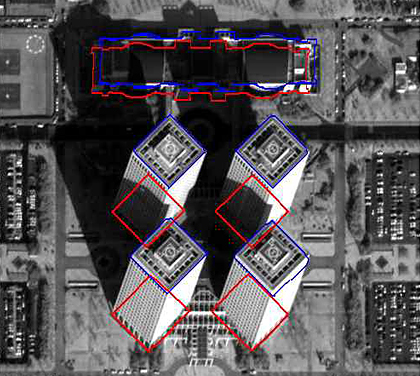
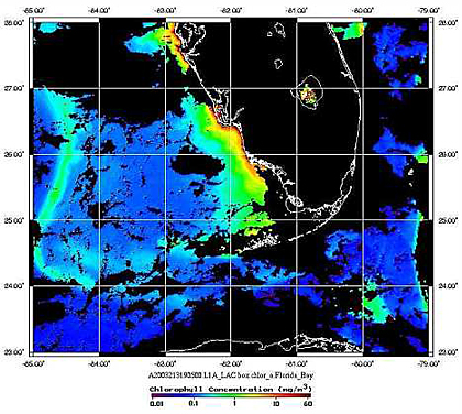
RS Lab has been researching satellite sensor modeling, satellite image processing, satellite image interpretation, photogrammetry, GPS, LiDAR(Light Detection And Ranging) and surveying. Major areas of recent technology development are 3D modeling using LiDAR, change detection using satellite data, 3D information of building extraction using high resolution satellite images, and Solar irradiance assessment. And these research results are widely used in various fields such as urban planning, exploration of resources, forest resource management, disaster management.